
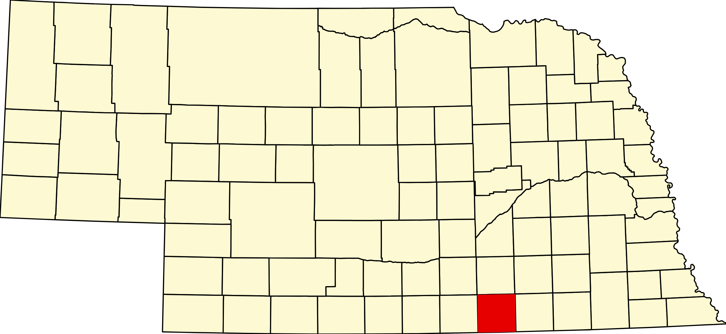
Nuckolls County, Nebraska
County seat: Nelson · Largest city: Superior · Created: 1860; organized June 1871 · Named for: Stephen F. Nuckolls, a founder of Nebraska City · License plates: prefix 42 · Population: 4,095 (2020 census); peak 13,236 in 1920 · Area: 575 sq mi
About Nuckolls County
Nuckolls County lies on the Kansas line in south-central Nebraska, with the Little Blue River crossing its northern half and the Republican River its southern edge. The territorial legislature drew its boundaries (Andreas says in 1858; the county dates its formation to 1860), and it was organized in June 1871, when D. W. Montgomery obtained an order for an election that was held under an elm tree at Oak Grove, with 33 votes cast. The name honors Stephen F. Nuckolls, a founder of Nebraska City and later Wyoming Territory's delegate to Congress (some accounts include his brother Lafayette). Nuckolls brought the first enslaved people into Nebraska Territory; two women escaped in 1858, and when he tried to seize one of them, Eliza Grayson, in Chicago in November 1860, an abolitionist crowd freed her.
The Oregon Trail, the overland stage and, in 1860–61, the Pony Express followed the Little Blue across the north of the county, and Oak Grove ranch near present Oak was the best-known stage station. In August 1864 raiders struck stations and ranches along the trail: two men were killed at Oak Grove on August 7, members of the Eubank family were killed and five people taken captive at the Narrows the same day, and nine men died near Little Blue Station on August 9. Markers at Oak and on NE 14 north of Nelson tell the story.
Nelson became the county seat in 1872, over Elkton and Vernon. Superior, surveyed in 1875 near the Republican, grew into the largest town and twice helped defeat courthouse bonds, but in 1889 voters approved $35,000 for the courthouse that still stands in Nelson. Railroads reached every part of the county in the 1880s: the Burlington through Hardy, Superior and Bostwick, from Edgar to Nelson and through Lawrence; the Missouri Pacific; the Rock Island through Ruskin and Nora to Nelson; the Fremont, Elkhorn & Missouri Valley through Oak and Nora to Superior; and the Santa Fe to Superior in 1887, a line BNSF still runs. Superior's Evelene Brodstone, Lady Vestey, built the town's hospital in 1927, and the Fuller automobile was built at Angus from 1907 to 1909.
Towns of Nuckolls County
Cities and villages
Superior
The county's largest town, 1,825 people on the bluffs above the Republican River near the Kansas line. The "Victorian Capital of Nebraska," home of Lady Vestey, Brodstone hospital, the county museum and a downtown on the National Register.
Nelson
The Nuckolls County seat, 456 people on NE 14 near the middle of the county. The 1890 courthouse, the Stansbury stone faces, a 1912 cemetery walkway on the National Register, and the county fair and rodeo.
Lawrence
Village of 272 on NE 4 in the county's northwest corner, platted on the Burlington in 1886. The 1901 Lawrence Opera House, Lawrence-Nelson's elementary school, and the 1875 St. Stephen parish south of town.
Ruskin
Village of 105 on US 136 in eastern Nuckolls County, the old Henrietta post office renamed for John Ruskin when the Rock Island arrived in 1887. Danish Lutheran roots south of town.
Hardy
Village of 97 a mile from the Republican River and the Kansas line, laid out in 1880 when the Burlington and the Missouri Pacific both arrived. Named for a Burlington official.
Oak
Village of 54 on the Little Blue River and the Oregon Trail, moved two miles west to the railroad in 1888. Oak Grove ranch, the 1864 raids, the Pony Express and captives markers, and the birthplace of Russ Snyder.
Nora
The county's smallest village, 21 people on US 136, laid out in 1887 where the Rock Island and the Elkhorn line met. The post office, opened in 1878, was named for Nora, Illinois.
Former towns and post office communities
Angus
Former village on the Little Blue, the Ox Bow mill settlement renamed in 1886 for a Burlington official. The Fuller automobile was built here from 1907 to 1909; the voters gave up incorporation in 1970.
Bostwick
Burlington railroad hamlet in the Republican valley about 7 miles west of Superior, first called Irving in 1885. Its post office closed in 1969; the cemetery remains.
Cadams
Hamlet between Superior and Nora, named for Superior banker C. Adams when Washington ran his name together. Post office from the 1890s to about 1940.
Oak Grove
Stage and Pony Express station on the Little Blue near Oak, attacked in the raids of August 7, 1864. Nuckolls County was organized here under an elm in 1871; a county monument marks the site.
Mount Clare
Missouri Pacific railroad hamlet on the ridge between the Little Blue and the Republican, first called Arnsburg. Post office from 1887 to 1945; about 131 people in 1920.
Smyrna
Burlington station on the line between Superior and Nelson, platted in 1886 and named for the seaport of Asia Minor. Post office from 1887 to 1913; Salem Lutheran Church (1899) still stands.
Travel Corridors
US 136 — the Heritage Highway, east–west across the county north of Superior and past Nora and Ruskin toward Deshler. US 136 Corridor →
NE 14 — north–south from the Kansas line through Superior and Nelson toward Clay Center, sharing about 4 mi with US 136. NE 14 Corridor →
NE 4 — east–west across the north through Lawrence, sharing about a mile with NE 14 north of Nelson. NE 4 Corridor →
State highways — NE 8 east from Superior toward Byron and Chester, and the S-65A spur from NE 4 south to Oak.
Historic trails: Oregon National Historic Trail → · Pony Express National Historic Trail →
Cameras: View Nuckolls County cameras → · Road conditions: Nebraska 511
Things to See
In Nelson, the 1890 courthouse, the Stansbury stone faces and the Nelson Cemetery Walk; in Superior, the downtown historic district, the 1937 City Hall and Auditorium, the Kendall House, the Nuckolls County Museum and Lady Vestey's grave in Evergreen Cemetery; the Lawrence Opera House; and at Oak, Oregon Trail Park, the Oak Grove Station monument and the 1864 raid markers, with the 1864 Indian Raids marker on NE 14 north of Nelson.
Outdoors
The county has no state park. Superior's Lincoln Park has free campsites with hookups, and Nelson's Harbine Park has campsites and the city pool. Liberty Cove Recreation Area, just across the line in Webster County near Lawrence, has RV pads, a beach and trails, and Lovewell State Park in Kansas lies a few miles south of Superior. Hunters can use the Smartweed Marsh and Smartweed Marsh West wildlife management areas near Edgar. Golfers have Superior Country Club and the public Elk Creek Country Club at Nelson.
Nuckolls County Business Directory
Businesses within 20 miles of: Superior · Nelson · Lawrence · Ruskin · Oak · All listings →
Adjacent Counties
Clay County (north) · Thayer County (east) · Webster County (west) · Jewell County, Kansas (south) · Republic County, Kansas (southeast); Fillmore County touches only at the northeast corner
Events
2026 dates: Superior's Victorian Festival on Memorial Day weekend (May 22–24); the Nuckolls County Fair and Rodeo at Nelson (July 29–August 1); and a Nebraska High School Rodeo Association rodeo at the Nelson fairgrounds on Labor Day weekend. Oak has staged a re-enactment of the 1864 raids every four years in August.
Events in Nuckolls County
- Nuckolls County Fair (Nelson)
Nuckolls County Fair, a county fair in Nelson, Nebraska. - Victorian Festival of Superior (Superior)
Victorian Festival of Superior is held in Superior, Nebraska, on Memorial Day weekend.
Know of another event in the county? Tell us about it.
Nuckolls County Road Map
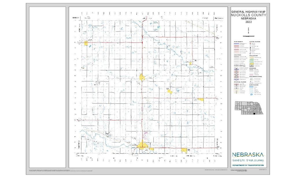
Download the full-size, printable county road map (PDF, Nebraska Dept. of Transportation)
Nuckolls County at a Glance
Nuckolls County, Nebraska — on the Kansas line between the Little Blue and the Republican. County seat Nelson; Superior is the largest city, with five villages.
Getting there: US 136 across the middle, NE 14 north from Kansas through Superior and Nelson, and NE 4 across the north.
For visitors: Superior's Victorian homes, downtown and county museum, Nelson's courthouse and stone faces, the Lawrence Opera House, and the Oregon Trail and 1864 raid sites at Oak. Hospital: Brodstone Healthcare in Superior.
Vehicles registered in Nuckolls County carry license plate number 42. See what every Nebraska county number means.
Nuckolls County Businesses & Places
135 listings in Nuckolls County.
Click a category to see the businesses.
Eat & Drink (3)
- Las Canteras — Mexican Restaurant, Nebraska
- Subway – 510 N Bloom, Superior — Subway, Nebraska
- Superior Estates Winery — Winery & Vineyard, Nebraska
Stay (1)
- Victorian Inn Motel & Suites — Hotel, Nebraska
Outdoors & Recreation (8)
- Elk Creek Country Club — Country Club, Nebraska
- Harbine Park — Campgrounds & RV Parks, Nebraska
- Harbine Park Disc Golf Course — Disc Golf Course, Nebraska
- Lincoln Park Campground — Campgrounds & RV Parks, Nebraska
- Lost Creek Disc Golf Course — Disc Golf Course, Nebraska
- Smartweed Marsh West WMA — Public Hunting Areas & WMAs, Angus
- Smartweed Marsh WMA — Public Hunting Areas & WMAs, Angus
- Superior Country Club — Country Club, Nebraska
Places to Visit (12)
- 1864 Indian Raids Historical Marker — Historic Marker, Nebraska
- Indian Ambush Marker — Historic Marker, Nebraska
- Kendall House — Attraction, Nebraska
- Lawrence Opera House — Attraction, Lawrence
- Nelson Cemetery Walk — Attraction, Nebraska
- Nuckolls County Museum — History & Heritage Museums, Nebraska
- Oak Grove Station Monument — Historic Marker, Nebraska
- Oregon Trail Park — City Parks, Nebraska
- Original Townsite of Oak Marker — Historic Marker, Nebraska
- Stansbury Stone Faces — Attraction, Nebraska
- Superior City Hall and Auditorium (1937) — Attraction, Nebraska
- Superior Downtown Historic District — Historic Districts, Nebraska
Events & Venues (3)
- Nuckolls County Fair — County Fair, Nebraska
- Nuckolls County Fairgrounds — Fairground, Nebraska
- Victorian Festival of Superior — Festivals & Celebrations, Nebraska
Health & Emergency (7)
- Brodstone Healthcare — Hospital, Nebraska
- Brodstone Memorial Hospital dba Brodstone FAMILY MEDICAL CENTER — Medical Clinic, Nebraska
- Brodstone Memorial Hospital dba Brodstone Family Medical Center - Nels — Medical Clinic, Nebraska
- Kile Veterinary Clinic — Mixed / General Practice, Nebraska
- Peak Dental Superior — Dentist & Dental Office, Nebraska
- South Central Veterinary Hospital — Mixed / General Practice, Nebraska
- Superior Pharmacy — Pharmacy, Nebraska
Shopping & Gifts (1)
- Ideal Market — Grocery, Nebraska
Community & Faith (35)
- Amateur Radio Repeaters - Nuckolls County (via RepeaterBook.com) — Amateur Radio Repeater, Nebraska
- Bethany Lutheran Church +PC(USA) — Lutheran Church, Nebraska
- Beulah Cemetery — Superior — Cemeteries, Nebraska
- Bostwick Cemetery — Bostwick — Cemeteries, Bostwick
- Centennial Lutheran Church — Lutheran Church, Nebraska
- Church of Christ in Nelson — Other Denomination, Nebraska
- Eubank Ranch Cemetery — Oak — Cemeteries, Nebraska
- Evergreen Cemetery — Superior — Cemeteries, Nebraska
- Grace Community Church — Evangelical Free Church, Nebraska
- Hardy Cemetery — Hardy — Cemeteries, Hardy
- Liberty Creek Cemetery — Lawrence — Cemeteries, Lawrence
- Lighthouse Community Church of the Nazarene — Other Denomination, Nebraska
- Mount Zion Cemetery — Oak — Cemeteries, Nebraska
- Nelson Cemetery — Nelson — Cemeteries, Nebraska
- Nelson Community UCC — Nelson — Congregational Church, Nebraska
- Nora Cemetery — Nora — Cemeteries, Nebraska
- Oak Grove Cemetery — Oak — Cemeteries, Nebraska
- Oxbow Cemetery — Nelson — Cemeteries, Nebraska
- Sacred Heart Catholic Church Lawrence — Catholic Church, Lawrence
- Sacred Heart Cemetery — Lawrence — Cemeteries, Lawrence
- Sacred Heart Nelson — Catholic Church, Nebraska
- Saint Mark’s E.L. Cemetery — Ruskin — Cemeteries, Nebraska
- Saint Stephens Cemetery — Lawrence — Cemeteries, Lawrence
- Salem Cemetery — Nelson — Cemeteries, Nebraska
- Salem Lutheran Church — Lutheran Church, Nebraska
- Smith Cemetery — Lawrence — Cemeteries, Lawrence
- Spring Creek Cemetery — Nora — Cemeteries, Nebraska
- St. Joseph Superior — Catholic Church, Nebraska
- St. Mark Lutheran Church — Lutheran Church, Nebraska
- St. Paul Lutheran Church — Lutheran Church, Hardy
- St. Peter Lutheran Church — Lutheran Church, Hardy
- St. Stephen Lawrence — Catholic Church, Lawrence
- Superior First UMC — Methodist Church, Nebraska
- Superior, First Presbyterian Church — Presbyterian Church, Nebraska
- Union Cemetery — Lawrence — Cemeteries, Lawrence
Government & Resources (30)
- Hardy Village Office — City Hall, Hardy
- Lawrence Post Office — Post Office, Lawrence
- Lawrence Village Office — City Hall, Lawrence
- Lawrence Volunteer Fire Department — Fire Station, Lawrence
- Nelson Fire Department — Fire Station, Nebraska
- Nelson Housing Authority — Housing Authority, Nebraska
- Nelson Post Office — Post Office, Nebraska
- Nelson Public Library — Libraries, Nebraska
- Nelson USDA Service Center — USDA Service Center (FSA/NRCS), Nebraska
- Nora Village Office — City Hall, Nebraska
- Nuckolls County Assessor — County Assessor, Nebraska
- Nuckolls County Attorney's Office — County Attorney, Nebraska
- Nuckolls County Clerk — County Clerk, Nebraska
- Nuckolls County Court — County Court, Nebraska
- Nuckolls County Courthouse — Court House, Nebraska
- Nuckolls County Driver License Office — County Driver License, Nebraska
- Nuckolls County Emergency Management — Emergency Management, Nebraska
- Nuckolls County Food Pantry — Food Pantry, Nebraska
- Nuckolls County Senior Services — Senior Citizen Center, Nebraska
- Nuckolls County Sheriff — County Sheriff, Nebraska
- Nuckolls County Treasurer — County Treasurer, Nebraska
- Nuckolls County Veterans Service Office — Veterans Office, Nebraska
- Nuckolls County Weed Superintendent — County Weed Control, Nebraska
- Oak Village Office — City Hall, Nebraska
- Ruskin Village Office — City Hall, Nebraska
- Superior City Hall — City Hall, Nebraska
- Superior Fire Department — Fire Station, Nebraska
- Superior Police Department — Police Station, Nebraska
- Superior Post Office — Post Office, Nebraska
- Superior Public Library — Libraries, Nebraska
Utilities (9)
- City of Nelson — Water Utility / District, Nebraska
- City of Superior — Water Utility / District, Nebraska
- Nelson Municipal Utilities — Electric Power Provider, Nebraska
- South Central Public Power District — Electric Power Provider, Nebraska
- Superior Municipal Gas — Natural Gas Provider, Nebraska
- Superior Municipal Utilities — Electric Power Provider, Nebraska
- Village of Hardy — Water Utility / District, Hardy
- Village of Lawrence — Water Utility / District, Lawrence
- Village of Ruskin — Water Utility / District, Nebraska
Education (9)
- Lawrence - Nelson Elementary School — Elementary & Middle School, Lawrence
- Lawrence - Nelson High School — High School, Nebraska
- Lawrence - Nelson Middle School — Elementary & Middle School, Nebraska
- Lawrence - Nelson Public Schools — School District (K-12 / General), Lawrence
- Nuckolls County Extension — County Extension Office, Nebraska
- Superior Elementary School — Elementary & Middle School, Nebraska
- Superior Middle School — Elementary & Middle School, Nebraska
- Superior Public Schools — School District (K-12 / General), Nebraska
- Superior Sr High School — High School, Nebraska
Automotive (5)
- Alexander Motors — Franchised New Car Dealer, Nebraska
- Bill's Transmissions Inc — Auto Repair, Nebraska
- Casey's General Store - Superior — Casey's, Nebraska
- Hayes Auto Sales — Used Car Dealer, Nebraska
- Rays Auto Sales — Used Car Dealer, Nebraska
Professional Services (4)
- Affiliated Brokers Insurance – Nelson — Insurance, Nebraska
- Central National Bank Superior — Banking, Nebraska
- Dana F. Cole & Company - Superior — Accountant, Nebraska
- Home Federal Bank – Superior — Banking, Nebraska
Media (3)
- KRFS 1600 AM and 103.9 FM - Superior — Radio Station, Nebraska
- Nuckolls County Locomotive Gazette — News Paper, Nebraska
- Superior Express — News Paper, Nebraska
Agriculture & Farm (2)
- Bomgaars – Superior — Bomgaars, Nebraska
- LandMark Implement – Superior — Equipment Dealers, Nebraska
Transportation (2)
- Midland Public Transit – Nuckolls County — Public Transportation, Nebraska
- Superior Municipal Airport — Municipal / General Aviation Airport, Nebraska
Personal Services (1)
- Price Funeral Home — Funeral Home, Nebraska