
Al Bengtson Trail: South Sioux City's Missouri River Trail System
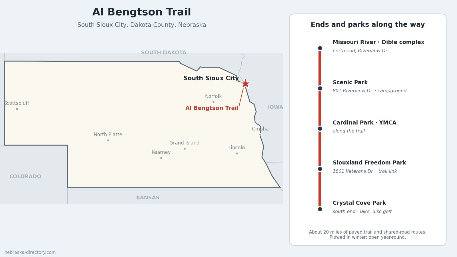
The Al Bengtson Trail is South Sioux City's network of paved trails, about 20 miles of off-street path and shared-road routes that tie the town's parks to the Missouri River. It runs from Crystal Cove Park on the south side of South Sioux City to the riverfront at the Jeffery C. Dible soccer complex, passing Scenic Park, Cardinal Park and the YMCA, and links to the trails of neighboring Dakota City. The city plows it in winter, so it can be used all year.
Trail at a Glance
- Length: About 20 miles of paved trail and shared-road routes. The city's own count is 19 miles of trail; TrailLink counts 22 miles including on-street links.
- Surface: Paved paths, with some sections on shared roadways.
- Uses: Walking, running and biking, year-round.
- Ends: Crystal Cove Park (W. 39th St. and Timberline Dr.) at the south; the Jeffery C. Dible soccer complex on Riverview Drive by the Missouri River at the north.
- Managed by: City of South Sioux City Parks and Recreation.
- County: Dakota County, in the far northeast corner of Nebraska.
Trailheads and Parking
- Crystal Cove Park — W. 39th St. and Timberline Dr. The 100-acre park has a 33-acre lake, its own 1.5-mile trail, fishing and an 18-hole disc golf course.
- Scenic Park — 801 Riverview Dr., on the river, with a city campground.
- Jeffery C. Dible soccer complex — Riverview Dr., 15 fields along the Missouri River and the trail.
- Siouxland Freedom Park — 1801 Veterans Dr., with a 50-space lighted lot; the park connects to the Siouxland trails system.
What You'll See
Missouri River views along Riverview Drive, the river-bottom parks of Scenic Park, and the lake at Crystal Cove. Siouxland Freedom Park, open around the clock, has a half-scale replica of the Vietnam Veterans Memorial Wall, a Korean War memorial, Nebraska's first Freedom Rock, walking paths and a dog park. Across the river in Sioux City, Iowa, the Sergeant Floyd Monument, a 100-foot obelisk from 1901, marks the grave of the only member of the Lewis and Clark expedition to die on the journey.
Connections
- Dakota City: the Jim Cahill Memorial Trail connects to the Siouxland trails system, and Cottonwood Cove Park (1301 Hickory St.) has a boat ramp and a 13-site RV campground.
- Siouxland Freedom Park: linked to the Siouxland trails system.
- Sioux City, Iowa: the city's riverfront trails are across the Missouri; check a current map for the best way across before you ride.
History Along the Trail
The first mile of trail opened in the late 1970s, from G Street to Cardinal Park. The network grew over the next decades, and in 2002 the city dedicated the whole system to Al Bengtson, a five-term city councilman and longtime civic leader who championed the trails. The Atokad section opened in 2018.
Nearby Places
- Scenic Park Campground — city campground on the Missouri, 801 Riverview Dr.
- Siouxland Freedom Park — veterans memorial park, 1801 Veterans Dr.
- Lewis and Clark Interpretive Center — on the riverfront in Sioux City, Iowa
- Ponca State Park — Missouri River bluffs and trails, northwest in Dixon County
Related Trails and Corridors
- Lewis and Clark National Historic Trail — follows the Missouri past South Sioux City
- US Highway 20 and US Highway 75 — through South Sioux City
- Nebraska Highway 12 — west along the Missouri to Ponca and Niobrara
- ← All Nebraska Trails