
City · Cuming County · Population 1,239 (2020 census) · ZIP 68791 · Founded 1871 · Peak population 1,335 (1980)
About Wisner
Wisner is a city of 1,239 on US 275 beside the Elkhorn River in northwestern Cuming County, where NE 51 begins. It calls itself the "Livestock Center of Nebraska," with about 130,000 cattle on feed nearby. It has Wisner-Pilger schools, the Franciscan Healthcare Wisner Clinic, the Wisner Public Library, the Wisner Heritage Museum and River Park, with camping, a rodeo arena and an Elkhorn River boat ramp.
History
Settlers arrived along the Elkhorn from 1865, and the area was set off as Elmont precinct in 1870. Stockholders of the Fremont, Elkhorn & Missouri Valley railroad platted the town in 1871 as the line arrived, and 63 lots were auctioned on July 26, 1871. It was named for Samuel P. Wisner, a railroad official, and stayed the end of the line until the tracks reached Norfolk in 1879. Wisner incorporated on May 14, 1873, and became a city of the second class in 1909.
Waterworks were approved in 1887, and Wisner had one of the first rural telephone lines in Nebraska in 1893. The Land of Nod amusement park operated from 1917 to 1940. The Elkhorn flooded the town in 1966, 1994 and 2010. Rail service ended in 1982 and the tracks came out in 1985. The population peaked at 1,335 in 1980. Frank Merriam, later governor of California, was once superintendent of Wisner's schools, and Medal of Honor Marine Dale M. Hansen and actress Virginia Huston were from Wisner.
Highways and trails through Wisner
| Route | One way | Other way |
|---|---|---|
| US 275Avenue E, through town | Northwest to Pilger (about 8 mi) and Norfolk (about 30 mi) | Southeast to Beemer (about 7 mi) and West Point (about 16 mi) |
| NE 51Begins at US 275 northwest of town | East past NE 9 to Bancroft (about 20 mi) and Decatur | Begins at US 275 |
Nearby towns
| Beemer | about 7 mi southeast | US 275 |
| Pilger | about 8 mi northwest | US 275 |
| Aloys | about 13 mi south | 6th Road and NE 32 |
| West Point | about 16 mi southeast | US 275 |
| Bancroft | about 20 mi east | NE 51 |
| Wayne | about 22 mi north | US 275 and NE 15 |
Things to see
Wisner Heritage Museum, 920 Avenue E, on US 275 (open by arrangement) · River Park on the Elkhorn: campground, rodeo and tractor-pull arenas and the boat ramp · Central Park, 1001 Avenue D, with a splash pad and a trail to River Park · Dinklage Park pool
Schools and health care
Schools: Wisner-Pilger Public Schools, 801 18th St.: elementary (pre-K–6) and high school (7–12)
Health care: Franciscan Healthcare Wisner Clinic, 2100 21st Circle; nearest hospitals Franciscan Healthcare, West Point (about 16 mi), and Faith Regional, Norfolk (about 30 mi)
Sources: U.S. Census; Wikipedia; Andreas, History of the State of Nebraska (1882); NEGenWeb Cuming County; History Nebraska; National Register of Historic Places; Nebraska Department of Transportation route mileposts. Distances marked "about" are estimates.
Navigate & Explore Wisner
Get directions to Wisner: Waze → · Google Maps → · Apple Maps →
Nearby businesses: Find businesses within 20 miles of Wisner →
Road conditions: Nebraska 511 — 511.nebraska.gov
Cameras: View Cuming County cameras →
Travel corridor: US 275 Corridor →
![History of Nebraska (Third Edition) [Paperback]](https://www.nebraska-directory.com/wp-content/uploads/2013/10/51faY4+Ux3L__SY300_.jpg)
51faY4+Ux3L__SY300_
cropped-hwy20x.jpg
Nebrask Inn
Nebrask Inn
Gross Nebraska Next 3 Exits
Gross Nebraska Next 3 Exits
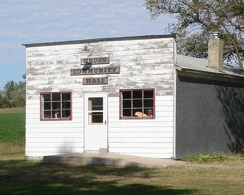
gross hall
Wisner Businesses & Places
46 listings in Wisner.
Click a category to see the businesses.
Eat & Drink (3)
- Coachmen's Family Steakhouse — Steakhouse
- Lantz's Steakhouse — Steakhouse
- Pizza Hut — Pizza Restaurant
Outdoors & Recreation (2)
- Wisner Boat Ramp – Elkhorn River — Boat Ramps & Marinas
- Wisner River Park — Campgrounds & RV Parks
Places to Visit (1)
- Wisner Heritage Museum Society — History & Heritage Museums
Health & Emergency (2)
- Franciscan Healthcare Wisner Clinic — Medical Clinic
- Just Be Therapeutic Massage and Float Spa — Massage
Community & Faith (16)
- Carter Cemetery — Cemeteries
- Christ Lutheran Church — Lutheran Church
- Heller Cemetery — Cemeteries
- Kaul Cemetery — Cemeteries
- Kumm Cemetery — Cemeteries
- Norwegian Cemetery — Cemeteries
- Saint Josephs Catholic Church Cemetery — Cemeteries
- Saint Matthews Lutheran Cemetery — Cemeteries
- Saint Paul Lutheran Cemetery — Cemeteries
- Salem Cemetery — Cemeteries
- St. Joseph Catholic Church Wisner — Catholic Church
- St. Paul Lutheran Church — Lutheran Church
- United Methodist Church of Christ (Federated) — Congregational Church
- Wisner Cemetery — Cemeteries
- Zion Saint John Lutheran Church Cemetery — Cemeteries
- Zion St. John Lutheran Church — Lutheran Church
Government & Resources (10)
- Cuming County Weed Superintendent — County Weed Control
- Elkhorn Logan Valley Public Health Department — County/District Health Department
- Goldenrod Regional Housing Agency — Housing Authority
- Wisner Area Chamber of Commerce — Chamber of Commerce
- Wisner City Hall — City Hall
- Wisner Community Senior Citizens, Inc. — Senior Citizen Center
- Wisner Fire Department — Fire Station
- Wisner Police Department — Police Station
- Wisner Post Office — Post Office
- Wisner Public Library — Libraries
Utilities (3)
- City of Wisner — Water Utility / District
- Wisner Municipal Gas — Natural Gas Provider
- Wisner Municipal Utilities — Electric Power Provider
Automotive (3)
- Heckmans Body Shop And Auto Sales — Auto Body Repair
- Thunder Valley Truck Sales — Truck Dealership
- Triple C Motor — Used Car Dealer
Education (3)
- Wisner-Pilger Elem School — Elementary & Middle School
- Wisner-Pilger High School — High School
- Wisner-Pilger Public Schools — School District (K-12 / General)
Agriculture & Farm (1)
- Central Valley Ag — Farm Coop
Professional Services (1)
- Steffensmeier Insurance Agency — Insurance
Media (1)
- Wisner News-Chronicle — News Paper