
Burt County Cameras
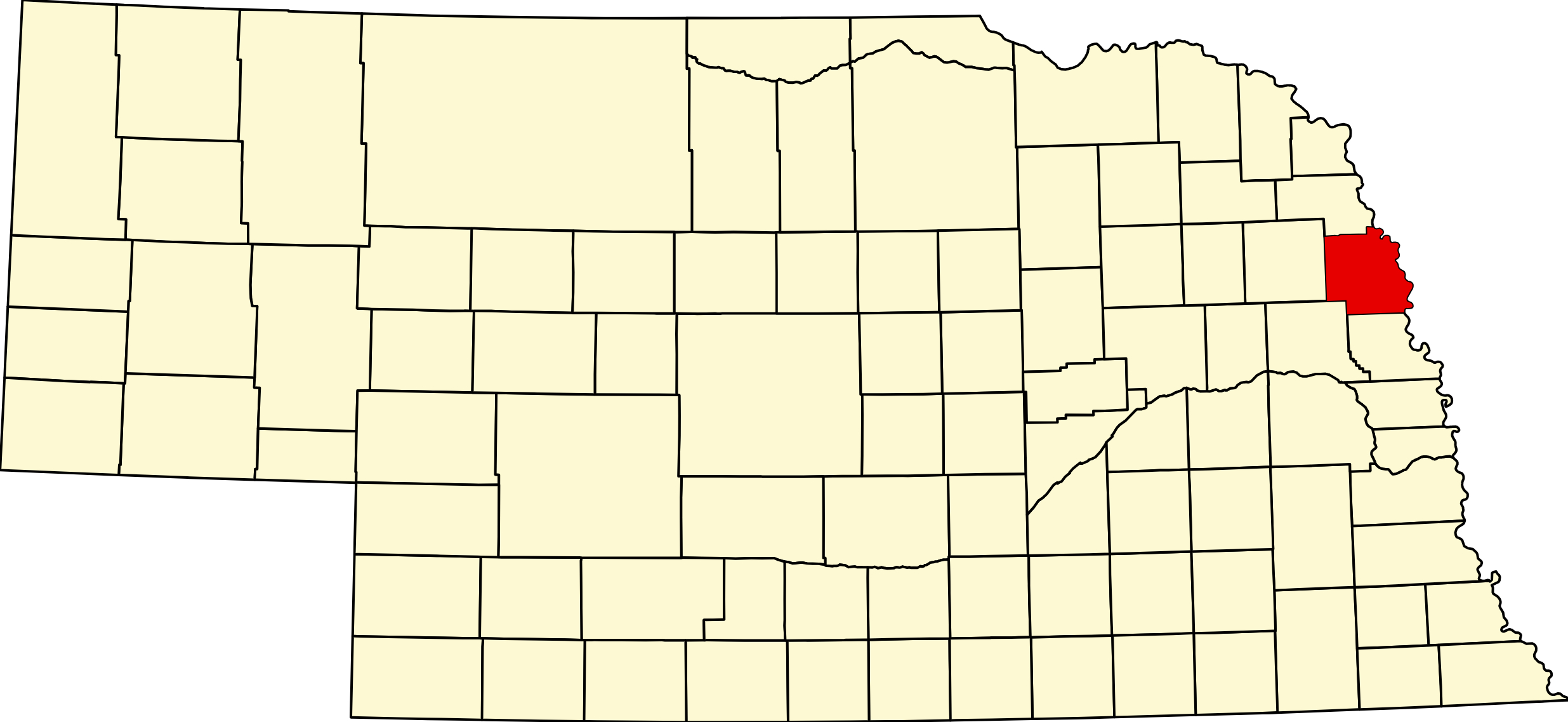
Burt County, Nebraska
County seat: Tekamah · Created: November 23, 1854 · Named for: Francis Burt, first governor of Nebraska Territory · License plate prefix: 31 · Population: 6,722 (2020 census) · Area: 492 sq mi of land
About Burt County
Burt County is one of the eight counties proclaimed by acting Governor Thomas Cuming on November 23, 1854. It is named for Francis Burt of South Carolina, the territory's first governor, who died days after taking office. Tekamah was claimed in October 1854 and made the county seat by the legislature on March 14, 1855; it has been the seat ever since. The present Beaux Arts courthouse was built in 1916–17. In 1879 the north line was moved about 8¼ miles north.
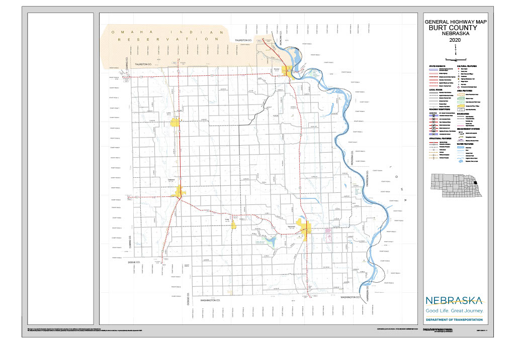
The Missouri River forms the eastern boundary, with wide bottomland below the bluffs; Logan Creek drains the rolling uplands to the west. The Omaha & North-Western railroad reached Tekamah in 1876, Oakland in 1879 and Lyons in 1880, and Craig grew up as a water stop in 1881; the lines were abandoned between 1963 and 1980. Swedish settlers made Oakland "the Swedish capital of Nebraska." Decatur, laid out in 1855, never got a railroad but has the only Missouri River bridge in the county. The county has no hospital since Oakland's ended inpatient care in 2021. The population peaked at 13,062 in 1930.
Towns of Burt County
Cities and villages
Tekamah
The county seat, a city of 1,714 on US 75 at the east end of NE 32, claimed in 1854. Beaux Arts courthouse, the Burt County Museum, six National Register buildings, golf and two state recreation areas nearby.
Oakland
"The Swedish capital of Nebraska," a city of 1,369 where US 77 meets NE 32 in the Logan Creek valley. The Swedish Heritage Center, the Burt County Fair each July, and 18 holes of golf.
Lyons
City of 824 on US 77 and Logan Creek, settled in 1866 and named for Waldo Lyon, whose deed still bars liquor sales in town. Island Park Campground and the Lyons-Decatur Northeast schools.
Decatur
Missouri River village of 410 on US 75, laid out in 1855 around Peter Sarpy's trading post. The 1955 bridge to Onawa, Iowa, Beck Memorial Park campground and Riverfront Days each June.
Craig
Village of 202 on NE 32 between Oakland and Tekamah, laid out in 1881 as a railroad water stop above the Bell Creek valley. Its early-1900s standpipe water tower is still in use.
Former towns and post office communities
Arizona
Former Missouri River landing and post office about 6 miles east-northeast of Tekamah, settled in 1855. The post office ran from 1867 to 1899; a cemetery and a few homes remain.
Argo
Ghost town of a Swedish farm settlement in the southwest corner of the county, about 6 miles southwest of Craig. Post office 1878–1904; the Argo Cemetery is still in use.
Bertha
Rural crossroads in central Burt County, about 7 miles east-northeast of Oakland. A post office named for Bertha Hansen ran from 1890 to 1900.
Basford
Ghost town near the north county line, about 6 miles west of Decatur. Its post office ran from 1895 to 1901; no buildings remain.
Golden
Ghost town on the old stage road between Tekamah and Decatur, named for a spring. The Golden Spring post office opened in 1875, became Golden in 1894 and closed in 1901.
Travel Corridors
US Highway 75 — north–south along the bluffs from Herman through Tekamah to Decatur and Macy. US 75 Corridor →
US Highway 77 — north–south up the Logan Creek valley from Uehling through Oakland and Lyons to Rosalie and Walthill.
NE 32 — east–west from West Point through Oakland and Craig to its end at US 75 in Tekamah. NE 51 — from US 77 north of Lyons east to Decatur and across the Missouri River to Onawa, Iowa, on the 1955 Burt County Missouri River Bridge, the county's only river crossing.
Burt County Business Directory
Businesses within 20 miles of: Tekamah · Oakland · Lyons · Decatur · Craig · All listings →
Adjacent Counties
Thurston County (north) · Cuming County (west) · Dodge County (southwest) · Washington County (south) · Monona and Harrison counties, Iowa (east, across the Missouri River)
Events
Decatur Riverfront Days is held in June, the Burt County Fair in Oakland in mid-July (July 17–21 in 2026), and Tekamah's Sweet Corn Festival in late July or early August. The Burt County Museum's Fantasy of Trees runs from late November through December.
Events in Burt County
- Burt County Fair (Oakland)
Burt County Fair, the county fair held each July at the fairgrounds in Oakland, Nebraska.
Know of another event in the county? Tell us about it.
Outdoors — Camping, RV, Hunting & Fishing
Burt County has two state recreation areas, town campgrounds in each of its cities and Decatur, and public access to the Missouri River at Decatur and Pelican Point. A Nebraska park permit is required at the state areas.
State recreation areas
Summit Lake State Recreation Area, 2787 County Road G, west of Tekamah: a 190-acre lake on 345 acres with 43 electric and 25 basic campsites, showers, a dump station, two boat ramps (5 mph limit), a beach, an archery range, 2 miles of hike-bike trail and the 10-mile Centennial equestrian trail. Reservations 1-844-637-2757.
Pelican Point State Recreation Area, 4699 County Road KL, on the Missouri River northeast of Tekamah: 36 acres, six primitive campsites, a boat ramp and dock, vault toilets, no drinking water. Phone 402-468-5611.
Town campgrounds
Beck Memorial Park, Decatur, on the Missouri: about 25 water and electric sites (some 50-amp), showers and a dump station, April–October. Island Park Campground, Lyons, on Logan Creek: electric sites, showers and a dump station, no reservations. Tekamah Memorial Park: eight 30-amp sites with a dump station nearby. Oakland City Park also has camping.
Missouri River and wildlife areas
Boats can be launched at Decatur and Pelican Point. Middle Decatur Bend (939 acres) and Little Sioux Bend (190 acres), owned by the Corps of Engineers, lie on the Iowa side of the river channel and are reached by boat. Check current Game and Parks rules and the river level before going.
Golf
Northridge Country Club, 3398 County Road H, Tekamah: 18 holes, par 72, public. Oakland Golf Club, 100 N. Parsons Ave.: 18 holes, par 72, semi-private.
Burt County at a Glance
Burt County, Nebraska — one of the eight original counties of Nebraska Territory, created November 23, 1854, on the Missouri River north of Omaha. County seat Tekamah.
Getting there: US 75 serves Tekamah and Decatur; US 77 serves Oakland and Lyons; NE 32 links Oakland, Craig and Tekamah; NE 51 crosses the Missouri at Decatur to Onawa, Iowa.
For visitors: the Swedish Heritage Center in Oakland, the Burt County Museum in Tekamah, camping and boating at Summit Lake and Pelican Point, and the Burt County Fair in Oakland each July. The nearest hospitals are in Blair, West Point, Pender and Onawa, Iowa.
Vehicles registered in Burt County carry license plate number 31. See what every Nebraska county number means.
Burt County Businesses & Places
149 listings in Burt County.
Click a category to see the businesses.
Eat & Drink (6)
- Chester's Oakland — Greek Restaurant, Nebraska
- Godfather's Pizza Express — Pizza Restaurant, Decatur
- Green Lantern Steak House — Steakhouse, Decatur
- Pop-n-Doc's — Restaurant, Decatur
- Silver Hills Vineyards & Winery — Winery & Vineyard, Nebraska
- Subway – 504 S 13th St, Tekamah — Subway, Nebraska
Stay (1)
- Tekamah Motel — Motel, Nebraska
Outdoors & Recreation (11)
- Beck Memorial Park – Decatur — Campgrounds & RV Parks, Decatur
- Brink Park Disc Golf Course — Disc Golf Course, Lyons
- Decatur Boat Ramp — Boat Ramps & Marinas, Decatur
- Decatur River Cabins — Campgrounds & RV Parks, Decatur
- Island Park Campground — Campgrounds & RV Parks, Lyons
- Northridge Country Club — Country Club, Nebraska
- Oakland City Park — Campgrounds & RV Parks, Nebraska
- Oakland Disc Golf Course — Disc Golf Course, Nebraska
- Oakland Golf Club — Golf Course, Nebraska
- Pelican Point State Recreation Area — Campgrounds & RV Parks, Nebraska
- Tekamah Memorial Park — Campgrounds & RV Parks, Nebraska
Places to Visit (12)
- Burt County Missouri River Bridge — Bridge, Decatur
- Burt County Museum — History & Heritage Museums, Nebraska
- Decatur Historical Committee and Robert E. Baker Memorial Museum — History & Heritage Museums, Decatur
- E.W. Bryant House — Specialty Museums, Nebraska
- Governor Val Peterson Historical Marker — Historic Marker, Nebraska
- Logan Creek Site Historical Marker — Historic Marker, Nebraska
- Lyons Historical Marker — Historic Marker, Lyons
- Pelican Point State Recreation Area — RV Camping, Nebraska
- Summit Lake State Recreation Area — RV Camping, Nebraska
- Swedish Heritage Center — History & Heritage Museums, Nebraska
- Tekamah Historical Marker — Historic Marker, Nebraska
- Victor Colson Homestead Historical Marker — Historic Marker, Nebraska
Events & Venues (4)
- Burt County Fair — County Fair, Nebraska
- Burt County Fairgrounds — Fairground, Nebraska
- Oakland City Auditorium — Community Center, Nebraska
- Tekamah Auditorium — Community Center, Nebraska
Health & Emergency (4)
- Burgess Family Clinic – Decatur — Medical Clinic, Decatur
- Cottonwood Rural Health Clinic — Medical Clinic, Nebraska
- Franciscan Healthcare Oakland Clinic — Medical Clinic, Nebraska
- Tekamah Drug Store — Pharmacy, Nebraska
Shopping & Gifts (1)
- Save More Market — Grocery, Nebraska
Community & Faith (39)
- Alder Grove Cemetery — Craig — Cemeteries, Craig
- Alder Grove UMC — Methodist Church, Craig
- Argo Cemetery — Craig — Cemeteries, Craig
- Arizona Community Cemetery — Tekamah — Cemeteries, Nebraska
- Bethany Lutheran Church — Lutheran Church, Lyons
- Craig Cemetery — Craig — Cemeteries, Craig
- Craig, First Presbyterian Church — Presbyterian Church, Craig
- Decatur UMC — Methodist Church, Decatur
- Deman-Hinds Cemetery — Decatur — Cemeteries, Decatur
- Emmanuel Lutheran Church — Lutheran Church, Nebraska
- First Baptist Church - Tekamah — Baptist Church, Nebraska
- Golden Spring Cemetery — Decatur — Cemeteries, Decatur
- Grace Cemetery — Oakland — Cemeteries, Nebraska
- Hillcrest Cemetery — Decatur — Cemeteries, Decatur
- Holy Family Catholic Church Decatur — Catholic Church, Decatur
- Holy Family Cemetery — Decatur — Cemeteries, Decatur
- Lyons Cemetery — Lyons — Cemeteries, Lyons
- Lyons, First Presbyterian Church — Presbyterian Church, Lyons
- Lyons, NE Memorial UMC — Methodist Church, Lyons
- New Life Assembly of God — Pentecostal, Lyons
- Oakland Cemetery — Oakland — Cemeteries, Nebraska
- Oakland Evangelical Free Church — Evangelical Free Church, Nebraska
- Oakland First UMC — Methodist Church, Nebraska
- Riverside Baptist Church — Baptist Church, Decatur
- Saint Johannes Argo Cemetery — Craig — Cemeteries, Craig
- Saint Johns Lutheran Church Cemetery — Lyons — Cemeteries, Lyons
- Saint Josephs Cemetery — Lyons — Cemeteries, Lyons
- Saint Pauls Lutheran Cemetery — Oakland — Cemeteries, Nebraska
- Salem Cemetery — Oakland — Cemeteries, Nebraska
- Silver Creek Cemetery — Tekamah — Cemeteries, Nebraska
- St. John Lutheran Church — Lutheran Church, Lyons
- St. Joseph Catholic Church Lyons — Catholic Church, Lyons
- St. Patrick Catholic Church Tekamah — Catholic Church, Nebraska
- Tekamah Cemetery — Tekamah — Cemeteries, Nebraska
- Tekamah First UMC — Methodist Church, Nebraska
- Tekamah Seventh-day Adventist Church — Seventh-day Adventist Church, Nebraska
- Tekamah, First Presbyterian Church — Presbyterian Church, Nebraska
- Trinity Lutheran Church — Lutheran Church, Decatur
- West Side Cemetery — Oakland — Cemeteries, Nebraska
Government & Resources (38)
- Burt County Assessor — County Assessor, Nebraska
- Burt County Attorney's Office — County Attorney, Nebraska
- Burt County Clerk — County Clerk, Nebraska
- Burt County Court — County Court, Nebraska
- Burt County Courthouse — Court House, Nebraska
- Burt County Driver License Office — County Driver License, Nebraska
- Burt County Emergency Management — Emergency Management, Nebraska
- Burt County Sheriff — County Sheriff, Nebraska
- Burt County Treasurer — County Treasurer, Nebraska
- Burt County Veterans Service Office — Veterans Office, Nebraska
- Burt County Weed Superintendent — County Weed Control, Nebraska
- Craig Village Office — City Hall, Craig
- Decatur Police Department — Police Station, Decatur
- Decatur Senior Citizens Action Group — Senior Citizen Center, Decatur
- Decatur Village Office — City Hall, Decatur
- Golden Oaks Center, Inc. — Senior Citizen Center, Nebraska
- Happy Days Senior Center — Senior Citizen Center, Lyons
- Lied Tekamah Public Library — Libraries, Nebraska
- Lyons City Hall — City Hall, Lyons
- Lyons Housing Authority — Housing Authority, Lyons
- Lyons Police Department — Police Station, Lyons
- Lyons Post Office — Post Office, Lyons
- Lyons Public Library — Libraries, Lyons
- Lyons Volunteer Fire & Rescue — Fire Station, Lyons
- Oakland Chamber of Commerce — Chamber of Commerce, Nebraska
- Oakland City Hall — City Hall, Nebraska
- Oakland Fire Hall — Fire Station, Nebraska
- Oakland Housing Authority — Housing Authority, Nebraska
- Oakland Police Department — Police Station, Nebraska
- Oakland Post Office — Post Office, Nebraska
- Oakland Public Library — Libraries, Nebraska
- Orville & Willa Chatt Senior Center, Inc. — Senior Citizen Center, Nebraska
- Tekamah Chamber of Commerce — Chamber of Commerce, Nebraska
- Tekamah City Hall — City Hall, Nebraska
- Tekamah Housing Authority — Housing Authority, Nebraska
- Tekamah Police Department — Police Station, Nebraska
- Tekamah Post Office — Post Office, Nebraska
- Tekamah USDA Service Center — USDA Service Center (FSA/NRCS), Nebraska
Education (10)
- Burt County Extension — County Extension Office, Nebraska
- Elementary School at Tekamah — Elementary & Middle School, Nebraska
- High School at Tekamah — High School, Nebraska
- Lyons-Decatur Northeast Schools — School District (K-12 / General), Lyons
- Northeast Elementary at Lyons — Elementary & Middle School, Lyons
- Northeast Secondary School — Elementary & Middle School, Lyons
- Oakland Craig Elementary — Elementary & Middle School, Nebraska
- Oakland Craig Junior-Senior High — High School, Nebraska
- Oakland Craig Public Schools — School District (K-12 / General), Nebraska
- Tekamah-Herman Community Schools — School District (K-12 / General), Nebraska
Utilities (8)
- Burt County Public Power District — Electric Power Provider, Nebraska
- City of Lyons — Water Utility / District, Lyons
- City of Oakland — Water Utility / District, Nebraska
- Logan East Rural Water System — Water Utility / District, Nebraska
- Lyons Municipal Gas — Natural Gas Provider, Lyons
- Lyons Municipal Utilities — Electric Power Provider, Lyons
- Village of Decatur — Water Utility / District, Decatur
- Wau Col Rws - East Side — Water Utility / District, Nebraska
Media (4)
- Burt County Plaindealer — Nebraska
- K34IB-D Channel 19 - Decatur — TV Translator, Decatur
- Lyons Mirror-Sun — News Paper, Lyons
- Oakland Independent — News Paper, Nebraska
Automotive (4)
- Chuck Rogers Auto LLC — Nebraska
- Hardland Sales And Rentals — Used Car Dealer, Decatur
- Mikes Auto Sales — Used Car Dealer, Lyons
- Tekamah Motors — Used Car Dealer, Nebraska
Professional Services (3)
- Brenneis Insurance — Nebraska
- FNIC – Tekamah — Insurance, Nebraska
- Lake Street Storage – Tekamah County Road GH — Self-Storage Facility, Nebraska
Transportation (2)
- Oakland Transportation System — Public Transportation, Nebraska
- Tekamah Municipal Airport — Municipal / General Aviation Airport, Nebraska
Manufacturing & Industrial (1)
- A-Z Tool Grinding Inc — Nebraska
Agriculture & Farm (1)
- Bomgaars – Tekamah — Bomgaars, Nebraska
Trades & Construction (1)
- Watertight Roofing — Nebraska